Main Body
1 Wild Winnipeg Project
Kamni Gill; Matthew Glowacki; and Owen Swendrowski-Yerex
The goal of the Wild Winnipeg Project has been to examine the shifting relationships people have had with animals over time and potential implications for designed urban landscapes. What should the relationship between humans and animals be within an ecological network of animate and inanimate nature? Historically the spaces and management of designed landscapes articulated socio-cultural relationships of people to animals, both wild and domesticated. This same consideration can reshape public spaces to allow for the fruitful co-existence of animals and urban dwellers during a time of diminishing biodiversity and mass extinction.
Infrared wildlife cameras were distributed in the Fort Garry and Riverview neighborhoods of Winnipeg to capture animal activity (figure 1.1). The aim was to document the parallel and frequently intersection lives of urban animals and people, and to heighten awareness of urban biodiversity over a period of two years from June 2020 to June 2022 through a combination of field research and public participation.
The research aims were:
- To establish a web-based public outreach process that engages city inhabitants in documenting animal encounters in Winnipeg.
- To establish an urban wildlife monitoring program in Winnipeg while evaluating computational methods for automated data collection and interpretation.
- To develop a case study series focused on urban habitat regeneration and design while creating guidelines for species-specific urban habitat prototypes.
- To evaluate the capacity for collaborative public projects that strengthen awareness and commitment to biodiversity.
- Finally, to design and construct a series of Research by Design habitats as a basis for long-term field research.
The project investigated suburban settings in Winnipeg to understand their potential for supporting urban wildlife. This information provided a valuable framework for identifying strategies that allow for the coexistence of humans and wildlife in urban areas. The first phase of the project (2020-2022) involved analyzing the spatial attributes of each scenario, understanding the ecological components present, and noting observed wildlife activity. The second phase of the project (2023-2025) involved the use of machine learning and other computational tools to analyze patterns of animal activity and the points of encounters or close encounters between humans and animals.
Camera trap data collection
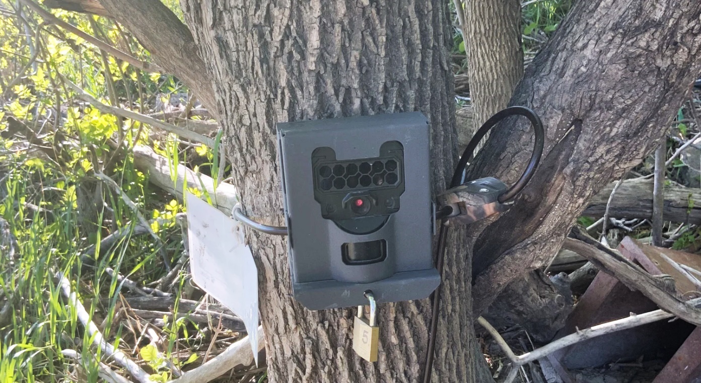
Figure 1.1: Camera trap data collection: a camera attached to a tree on the banks of the Red River, Fort Garry, Winnipeg.
Trail cameras were set up in over 20 locations from June 2020 to June 2022. Camera traps were configured to capture a stream of images when triggered by movement. The sensitivity of the camera was adjusted for each location to limit the number of false activations. Windy days were a particular challenge, and whitecaps on water were guaranteed to activate the camera continuously for as long as the wind persisted. Images were collected roughly every two weeks, less so during the winter months.
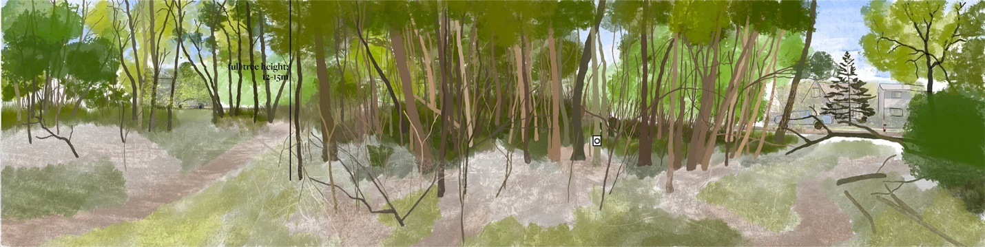
We placed cameras in suburban woodland remnants near, but not directly on, human corridors like streets, alleys, or footpaths. Half the sites were in isolated woodland patches (suburban block-sized or smaller), while half were in continuous riparian forest along the Red River’s west bank. Sites varied in vegetation density (thick understory to open meadows) and proximity to development (3-200m buffer from high human activity zones). All sites had some level of human activity and were observed throughout all seasons. There were a few location changes that prevented some sites from being observed all year long.
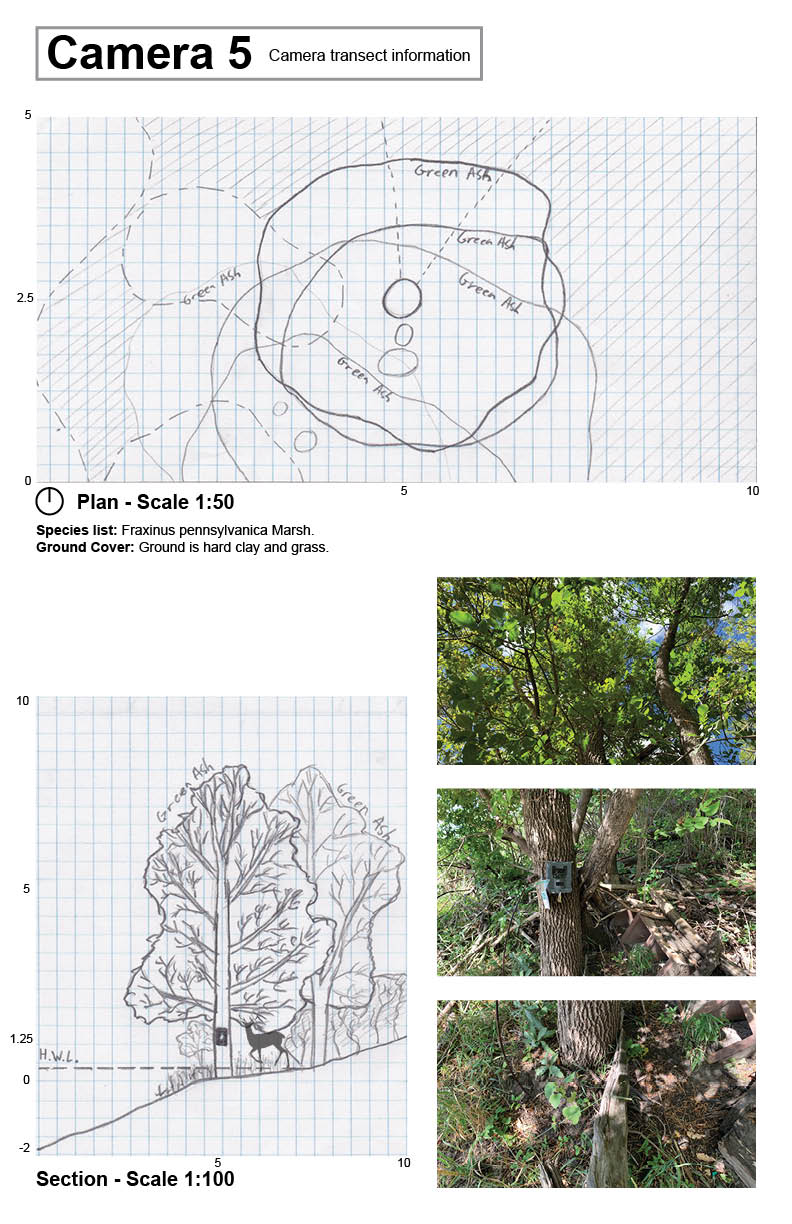
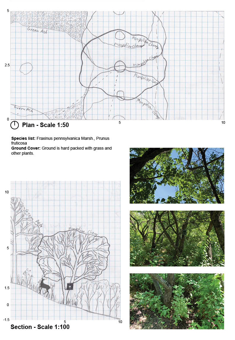
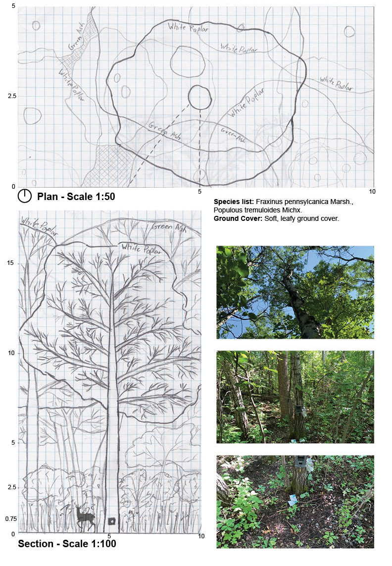
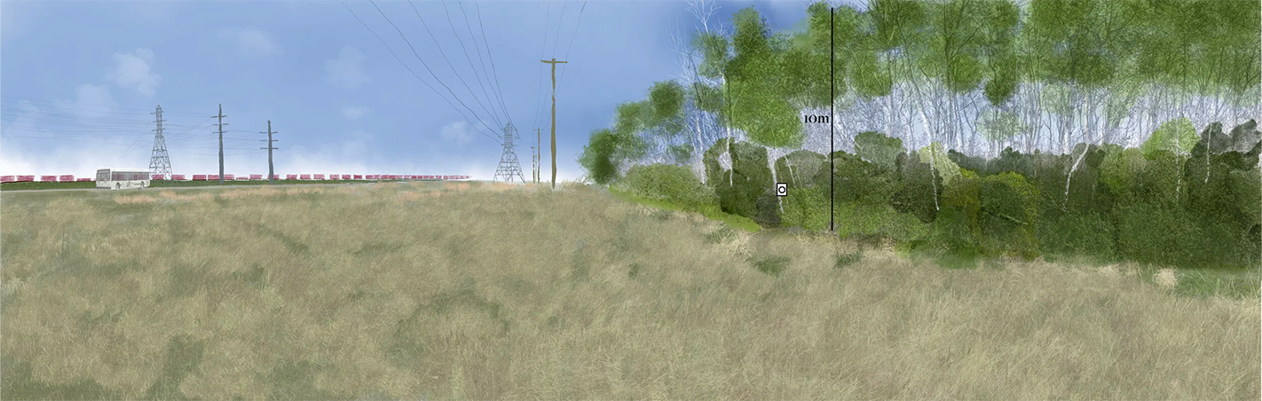
Documenting the Collection Locations
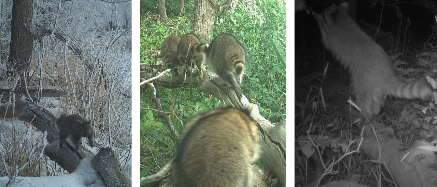
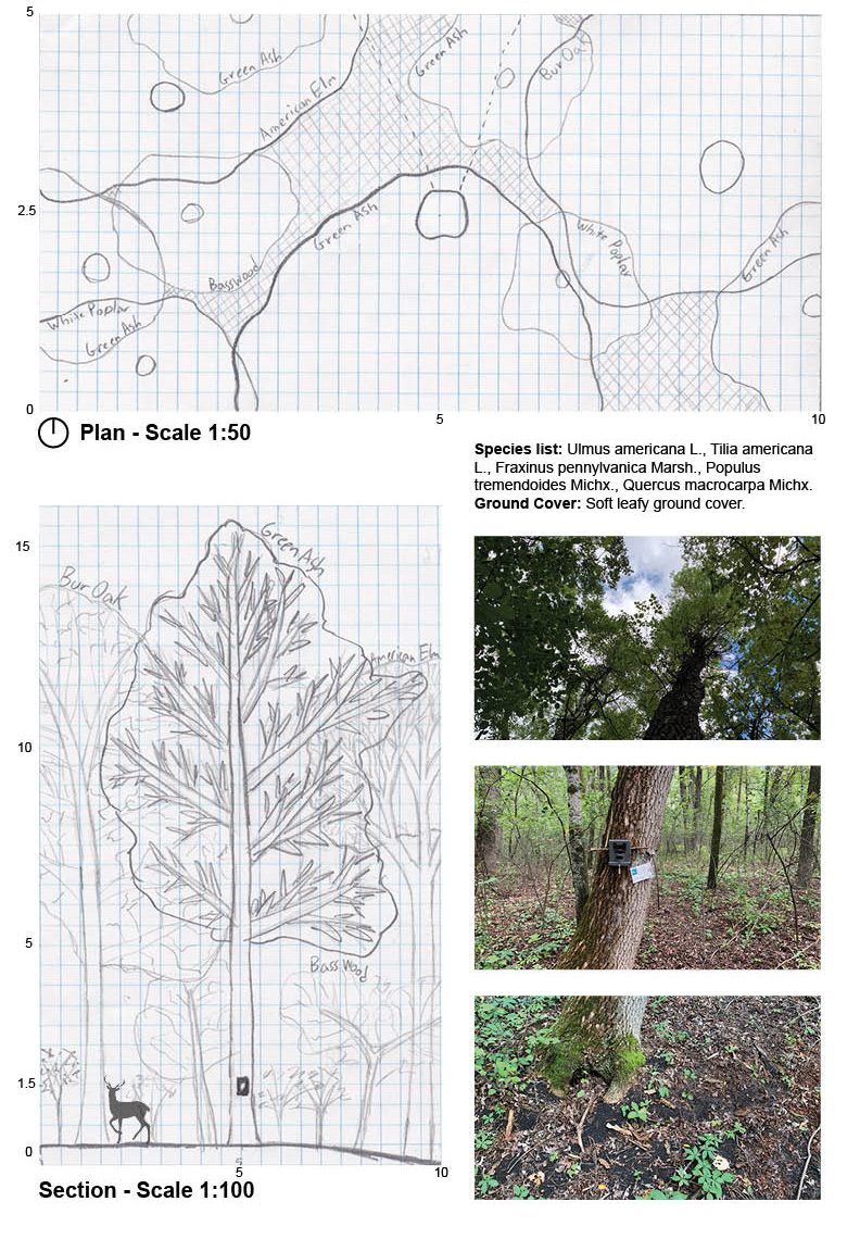
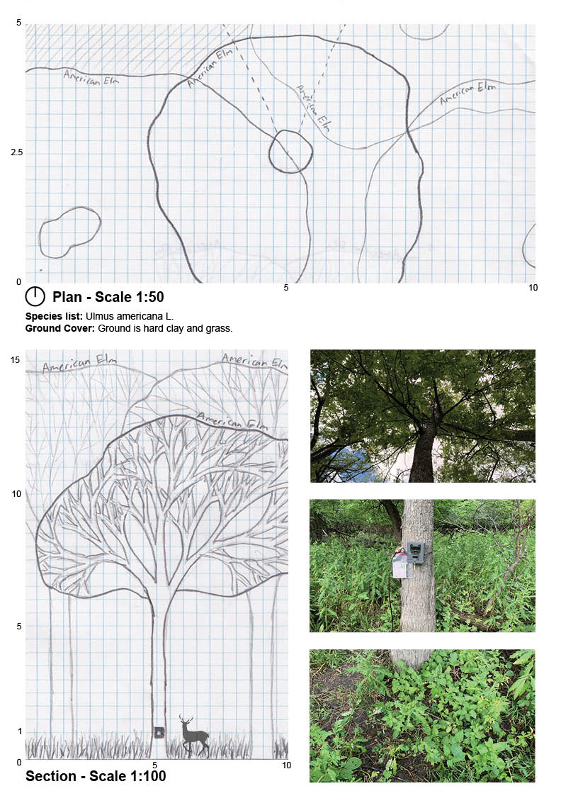
Each camera site was documented in a series of drawings and photographs that aimed to capture the quality of the tree canopy and understory, as well as proximate built elements. The canopy drawings aimed to capture the shading and lighting characteristics of the site. These drawings were based on a plan base drawing which located the trunks of the major vegetation of an inch diameter and larger. The camera location and angle were also documented within the drawings. Transect sectional drawings accompanied the plan to gain a better understanding of the site characteristics and forest profile. Digital images were also taken of the site as well as the condition of the camera trap. Some locations were not particularly active with animals, while others happened to coincide with a route used by multiple species, like the log at camera 9 (figure 1.2).
The variety of plant and animal life present in urban environments, which the Wild Winnipeg Project aimed to document and heighten awareness of through camera trap monitoring and public engagement.
A branch of AI that enables computers to learn from data by analyzing patterns and trends in large datasets, using algorithms to make predictions, recognize objects, and generate new ideas based on learned information.
Two or more mammals observed by a camera at the same location on the same day within ten minutes of each other. Any observations meeting these criteria but that occur within one minute of each other are classified as a ‘sequence,’ which counts as a single observation of the identified mammal.
Small patches of forest that remain in suburban areas, often isolated and block-sized or smaller, which serve as important habitat for urban wildlife despite their proximity to human development.
Pathways or zones that facilitate movement and connectivity for both wildlife and humans in urban environments, such as multi-use paths along levees or riparian areas that allow species movement while accommodating human activity.
Forest habitat along riverbanks that provides a continuous connective framework for wildlife movement between different urban areas, particularly important along the Red River’s west bank in the study.
The layer of vegetation beneath the main canopy of a forest, an important habitat component documented at camera trap sites that varies in density from thick vegetation to open areas.
The cross-sectional view or vertical structure of a forest ecosystem that shows the different layers of vegetation from ground level to canopy, used in wildlife habitat analysis to understand site characteristics and environmental conditions.
